

Total MILES WALKED: 1022
Currently on: DONE!
Last Check-in: Aberdyfi (Because I AM FINISHED!!!)
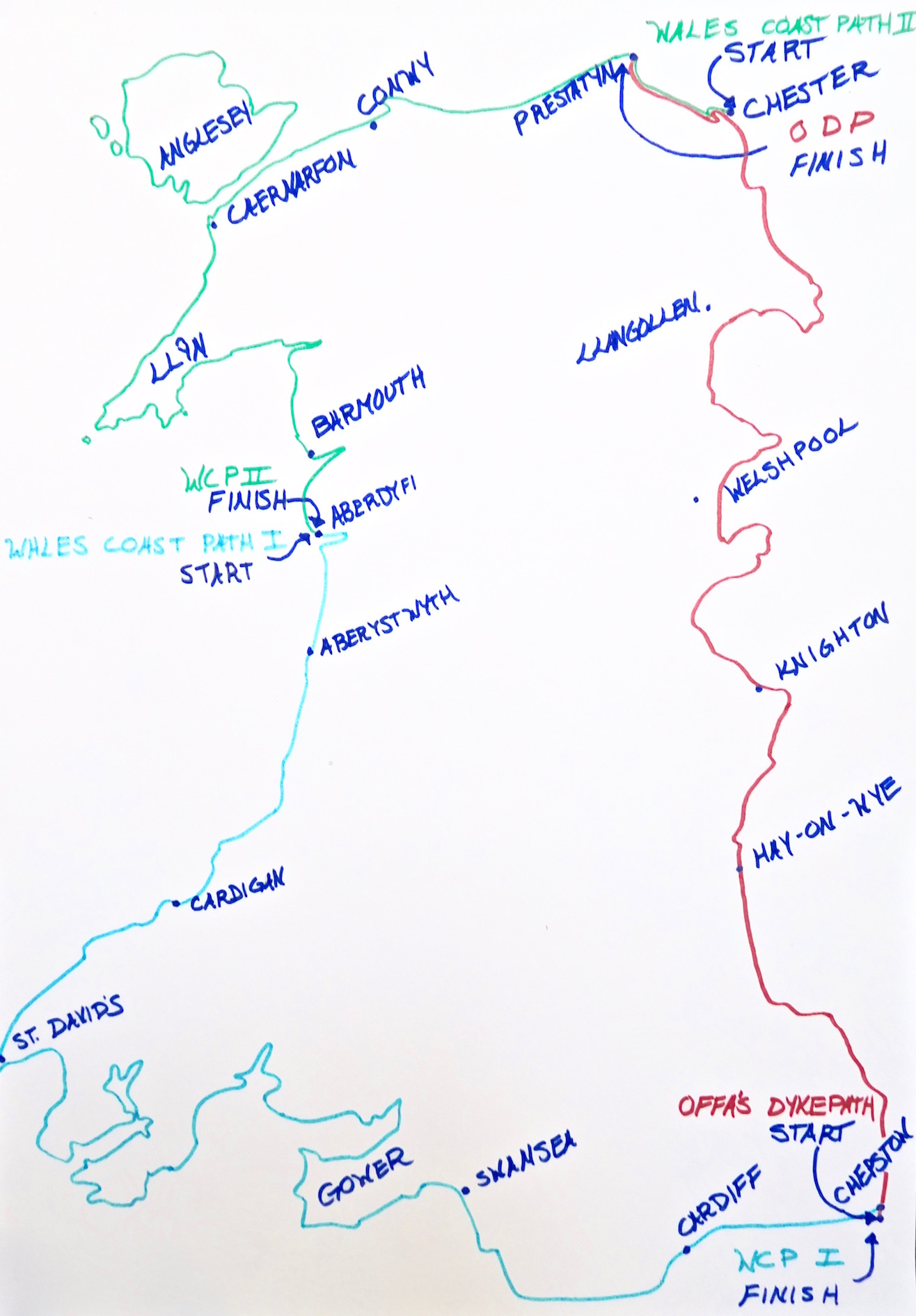
So, I've finally started the third and final leg of my hike - following the Wales Coast Path from the north coast of Wales to Anglesey, the Llyn Peninsula, and eventually back down to Aberdyfi. It's been a long road.
Links to my blogs of the first and second legs of my hike Leg I the Wales Coast Path (South) and Leg II the Offa's Dyke Path are below.
I'll update the blog as much as I can, but just so you know it isn't in real time. Though it's not that far behind where I actually am, it just isn't possible without consistent wifi access to do something entirely live where I put up new posts every day (so basically, don't take any of my blog entries as an indication of present weather. . .). But it really is close enough.
And if you're wondering why I started in Aberdyfi rather than Chepstow or Chester like a normal person - because the path runs across my front door, so it seemed easier to just start (and end) in the middle. . .


